The Early Days
Sun, 17/10/2010 - 16:06 — balint
These are screenshots from the first working version of the system. You'll notice one obvious bug: some of the altitudes are impossibly high (the was an extra un-necessary bit shift).
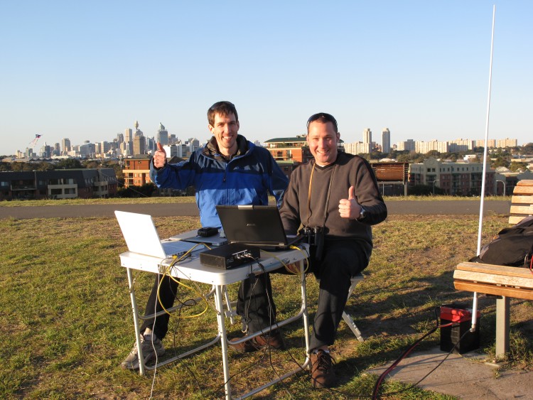
If you wish to see photos of the first proper outdoor test of the system on top of the tallest hill in Sydney Park, please have a look at the album in my gallery.
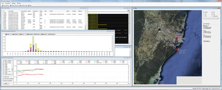
- The entire app:
- In a web browser with the Google Earth plugin:
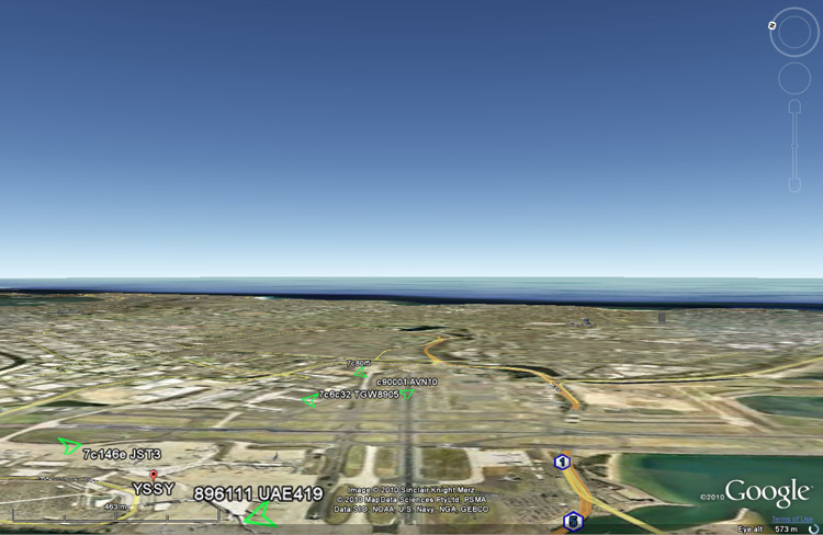
- VAU28 coming in to land on RWY25:
- Here's a sample of the map:
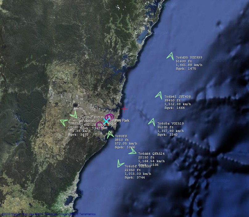
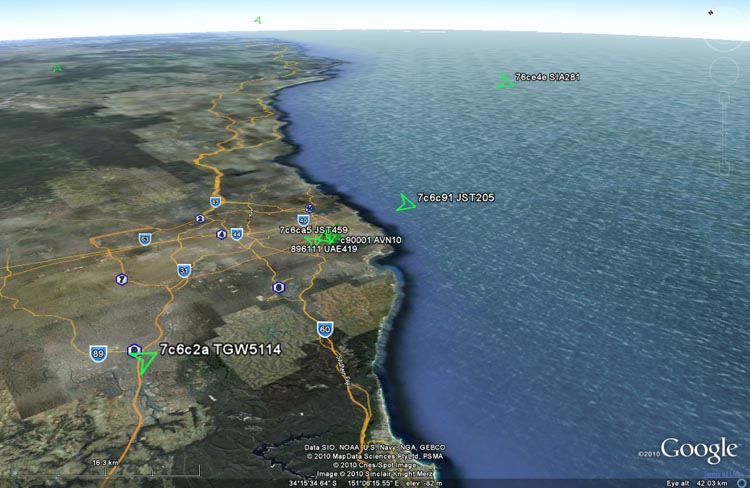
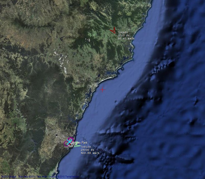
- This aircraft is the furthest one received so far (just shy of 300km):
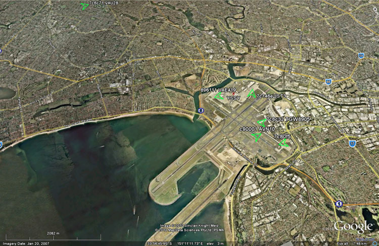
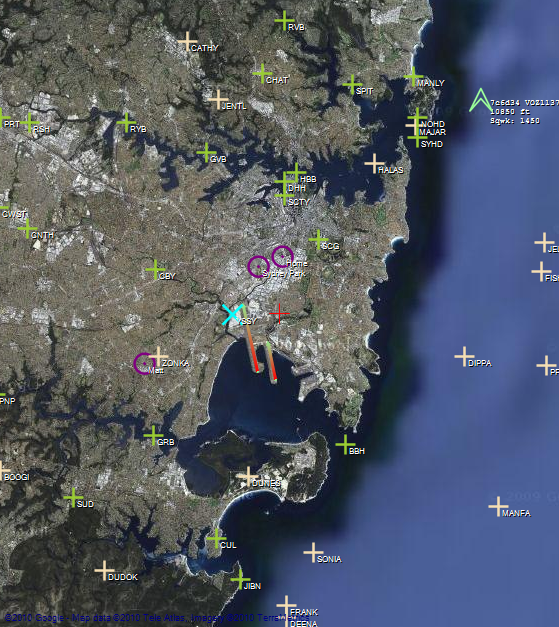
- The map can show some extra information, such as IFR/VFR markers, as well as the current runway configuration of your favourite airport (notice the red-green lines on 34L & R indicating the take-off direction):
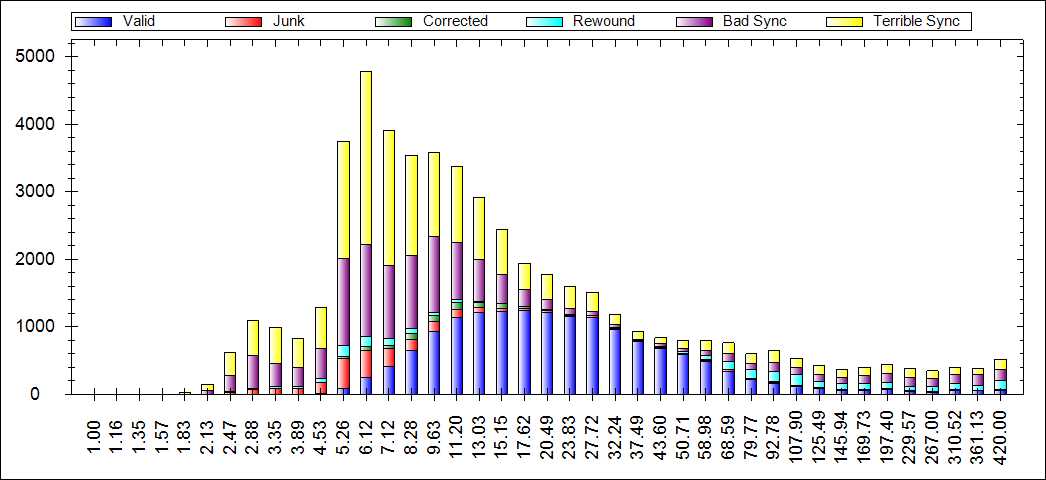
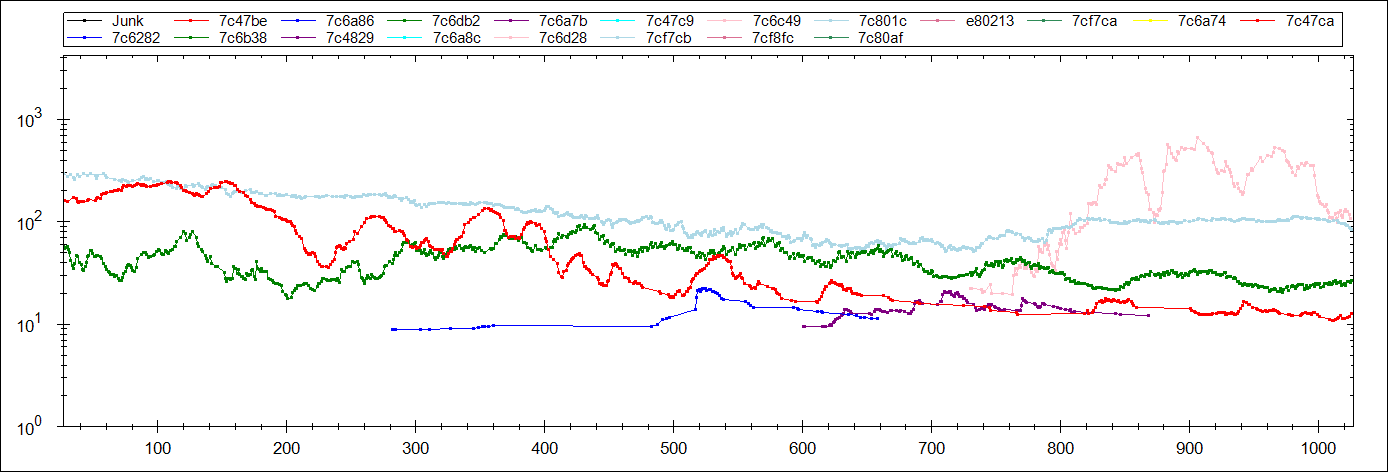
- The signal-strength distribution plot shows how the decoder is performing over a range of RSSI values:
- There is also a per-airframe RSSI graph which is interesting to follow as an airframe approaches/flies away from the antenna:
- Happy with the results (from the photo album of the first outdoor test):
All content copyright © Balint Seeber 1999-2026. All rights reserved.


Popular content
Today's:
All time:
- About
- How to recover a RAID 0 disk array after losing the array’s metadata
- Making your iPhone look like a NMEA GPS receiver with gpsd and WiFi or Bluetooth
- Aircraft Tracking with Mode S: Modez & Aviation Mapper
- Australian Geographical RadioFrequency Map
- Windows Side-by-Side Assemblies (WinSxS)
- Dual monitor Quake III
- Determine the order of the physical disks in the array
- Tearable Cloth
- Software Defined Radio
Last viewed:
- Simplified Makefile System
- About
- My blog lives elsewhere...
- Restore the MBR and partition information, therefore restoring the file system
- Voice-controlled sheep press (AKA 'The Run-Son')
- Turning the Navman S150 into a Bluetooth GPS receiver
- Update
- TokyoCabinet and TokyoTyrant DLLs for Windows MSVC
- NISRP: the Non-Intrusive Song Rating Plugin for Winamp and iTunes
- WiFi Adventures
AntiSpam spam counter
