RF
Mode S in the US
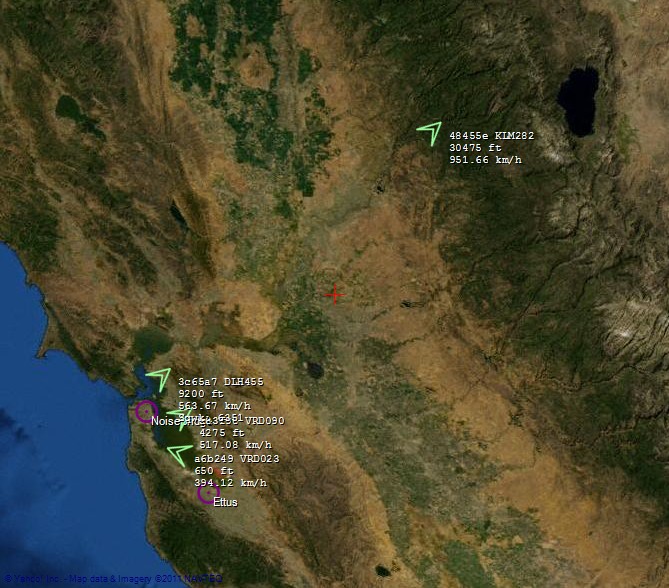
Sun, 24/07/2011 - 15:37 — balintSan Francisco & Silicon Valley:
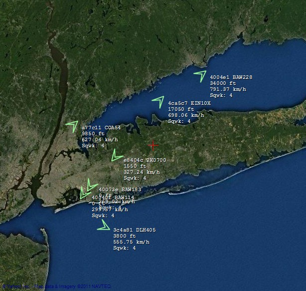
New York, New York:
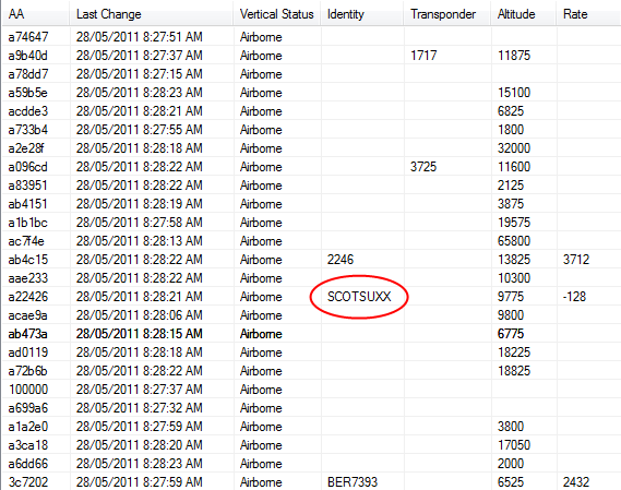
SCOTSUXX:
Evolution: Cool Moments for Modez
Mon, 23/05/2011 - 18:30 — balintThe following series of images were captured/created when a milestone or new record was reached. There are more technical images and notes on the Modez wiki page. If you wish to see photos of the last major outdoor test, which involved five laptops, two USRPs and an SBS-1, please visit the album in my gallery.
Comparison to SBS-1
Mon, 23/05/2011 - 18:13 — balintThe aviation tracking system ("Modez") and an SBS-1 (thanks to Matt Robert) with its Base Station software were run side-by-side to undertake a rough performance comparison. For various technical notes on the SBS-1, including sampling the baseband output with an LFRX daughterboard, please see the page on my wiki. If you're interested in the photos of the major outdoor test where the SBS-1 was pitted against Modez, visit the album on my gallery.
HF (WBX + Transverter)
Sun, 22/05/2011 - 23:04 — balintThe SDR hardware has been taken on a few digitally-enhanced 'DXpeditions'. The first was to our favourite hill in Sydney Park, and the second being the excellent cliff-side WWII bunker at North Head (click either link to see the day's/night's photos).
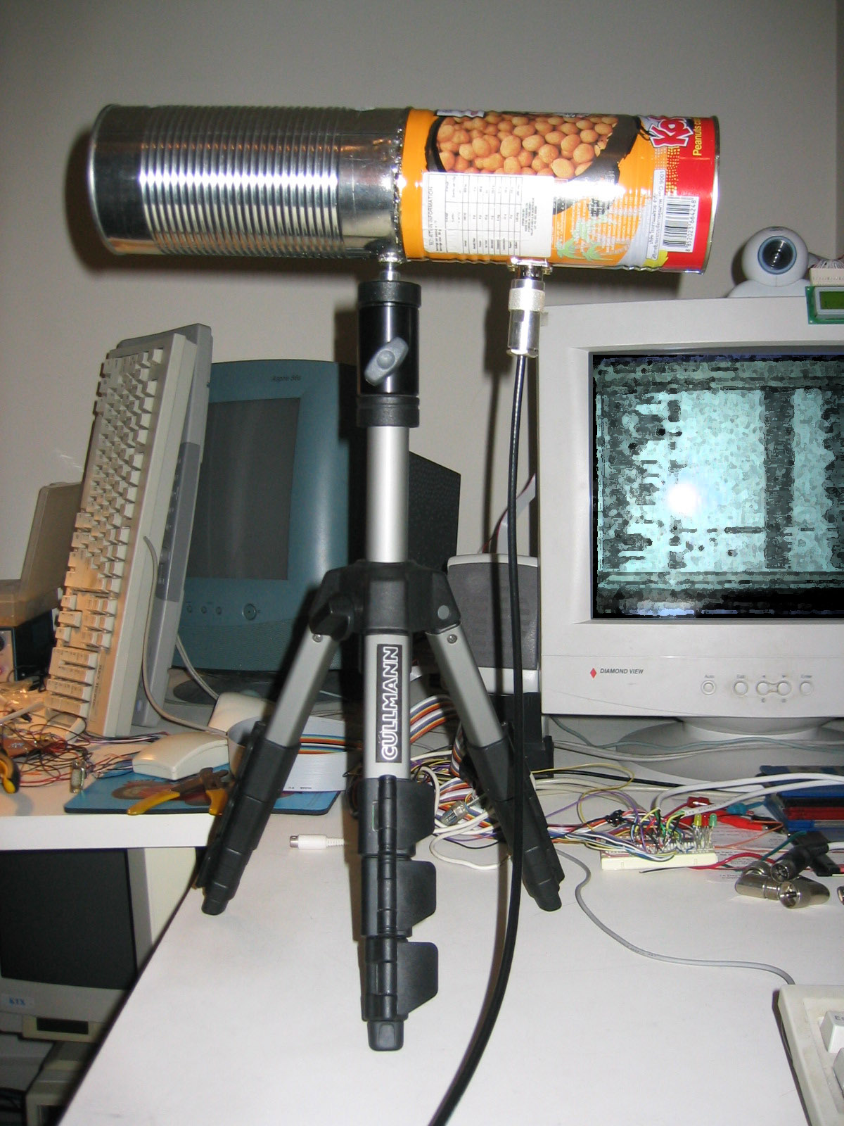
Here is the USRP in action (in my custom housing) connected to a transverter, which is in turn connected to a long-wire antenna for HF reception:
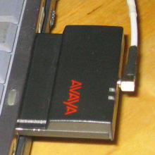
USRP
Sun, 22/05/2011 - 22:55 — balintThe USRP is an Software Defined Radio created by Ettus Research. I have one with a WBX daughterboard.
For various notes and experimental results concerning the USRP, please have a look at the dedicated page on my wiki.
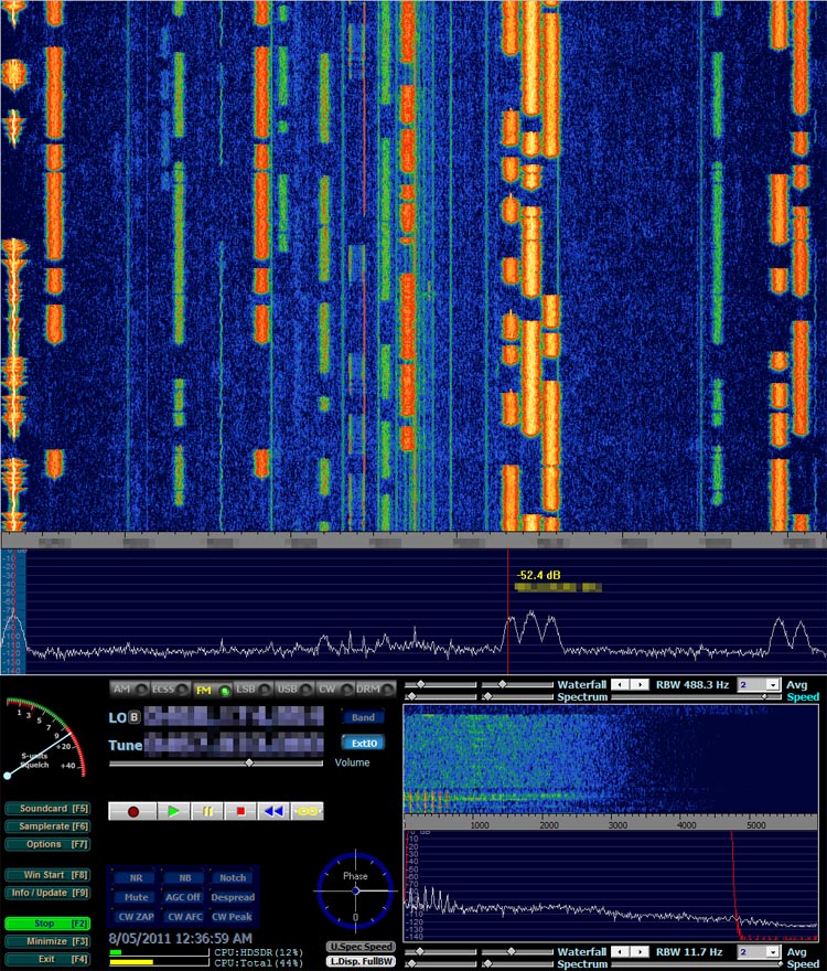
Winrad ExtIO input for USRP
Sun, 22/05/2011 - 20:02 — balintWinrad and its forks (HDSDR & WRplus) are software radio interfaces that run on Windows. They support a number of SDRs as input sources (known as ExtIO plugins). There was previously one for the USRP, however I decided to write a new one with UHD and legacy support, and much more (e.g. remote control and streaming over a LAN).
Software Defined Radio
Sun, 22/05/2011 - 19:42 — balintMy Software Defined Radio experiments featured in GQ Australia (April/May) 2012!

SDR-powered Aviation Mapper is now LIVE! Click here to use it.
The Aviation Mapper launch video
Have a look at my Hi-Def intro video on using SDR on HF that was featured on Slashdot:
(The 'cheap SDR' they refer to can be found on my wiki for GNU Radio/Linux and Windows.)
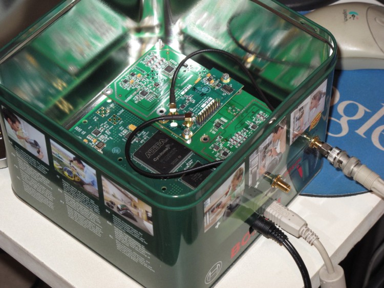
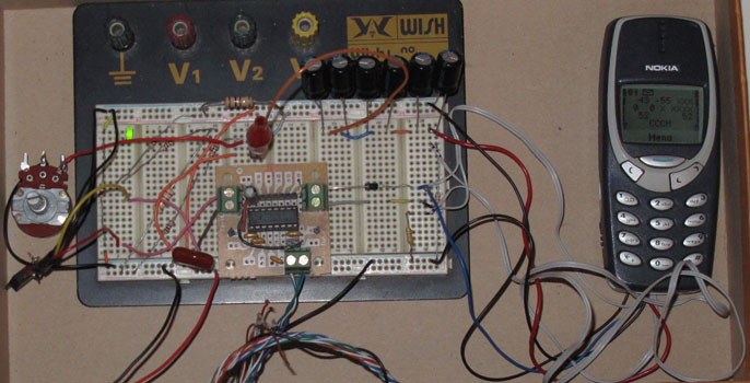
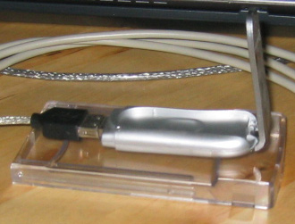
The Software Defined Radio (SDR) I currently use is the Universal Software Radio Peripheral (USRP) 1 made by Ettus Research (in a custom housing!):
I've used it for several of my projects, including an aviation tracking system with a live streaming 3D Google Earth front-end:
Demonstration of BorIP network streaming between HDSDR and GNU Radio using USRP 1:
Example of HDSDR using USRP:
Presentation at Dorkbot
Fri, 05/11/2010 - 23:39 — balintHere are some excerpts of the presentation Matt Robert and I gave at the October 2010 meetup of Dorkbot Sydney.
If you wish to see all of the photos from the set-up phase prior to the presentation on the roof of my apartment block, please have a look at the album in my gallery.
The Early Days
Sun, 17/10/2010 - 16:06 — balintThese are screenshots from the first working version of the system. You'll notice one obvious bug: some of the altitudes are impossibly high (the was an extra un-necessary bit shift).
If you wish to see photos of the first proper outdoor test of the system on top of the tallest hill in Sydney Park, please have a look at the album in my gallery.
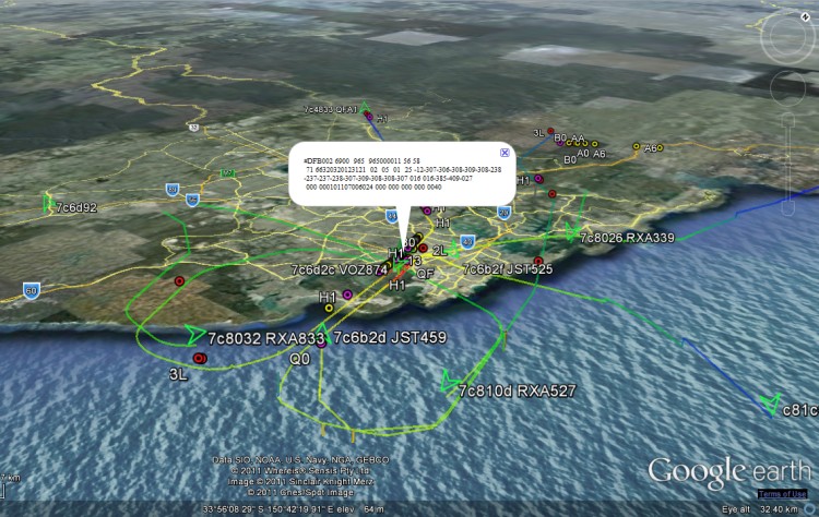
Aircraft Tracking with Mode S: Modez & Aviation Mapper
Sun, 17/10/2010 - 15:50 — balintAviation Mapper is LIVE! Click here to use it.
The Aviation Mapper launch video
This project is a completely home-grown implementation of an aircraft tracking system using Mode S messages received on a Universal Software Radio Peripheral (USRP) from Ettus Research. The system comprises of a software-defined baseband decoder, a GUI front-end and a real-time (smooth) JavaScript-enabled Google Earth feed.
For the Mode S/aviation/RF enthusiast: If you are interested in various notes, diagrams and screenshots that are more technical than these series of pages, please check out the dedicated page on my wiki as well.
Modez, Aviation Mapper and Software Defined Radio featured in GQ Australia (April/May)!
Screenshots from the GUI front-ends:
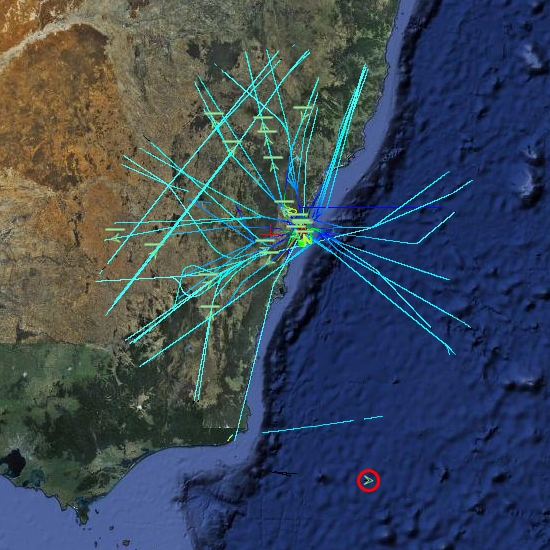
A plane at 514 km, with trails left behind showing flight corridors
Looking at an angle at Sydney Airport, with planes landing on overlapping approach trails.
ACARS messages shown spatially as coloured dots with message label and content in balloon pop-up.
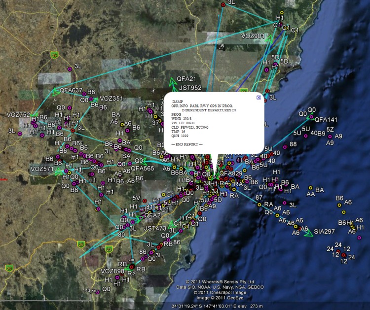
Spatial representation of ACARS message transactions building up over half a day
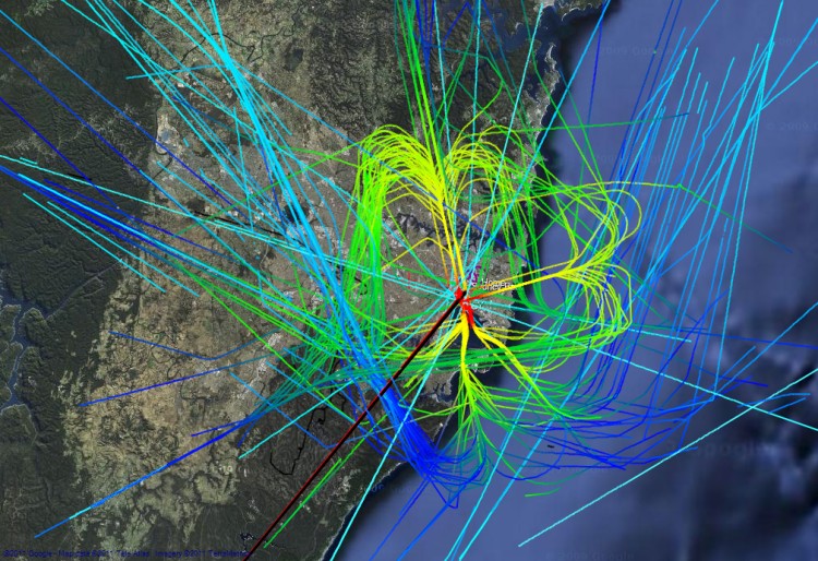
Accumulated flight paths over half a day
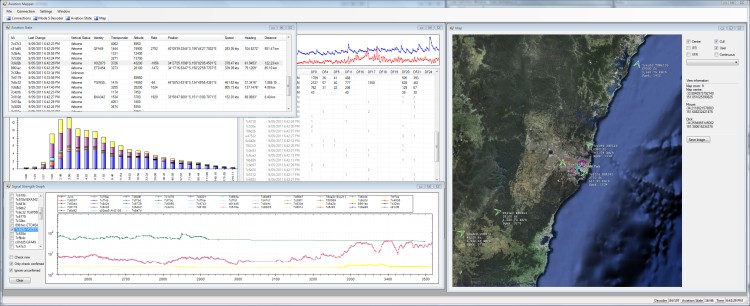
The Aviation Mapper desktop app
Geolocation Experiment using the Mobile GSM Cellular Network
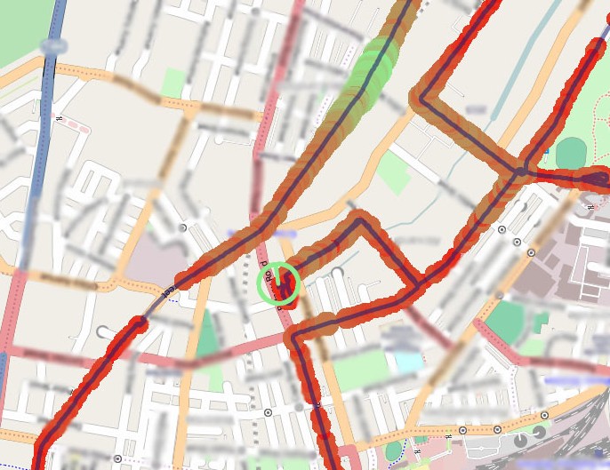
Tue, 23/02/2010 - 12:49 — balintThis experiment involved acquiring CellID and signal strength information from the GSM cellular network, tracking one's position while acquiring this data, and finally presenting it nicely. It is summarised in the following pictures (full details are described in the sub-sections found top-left):
Mapping position and signal strength measurements:
Atmel at76c503a Wireless USB Adapter
Mon, 13/08/2007 - 11:53 — balintThis started with my desire to build a Woktenna.
Of course you can't very well put a PCMCIA wireless card at the focal point of a cooking wok!
So the alternative is using a USB WiFi adapter that can hang on the end of a USB extension cable and
introduce minimal analog signal loss and USB is digital!
Despite the fact is says "Linux compatible" on the box, it wasn't immediately possible to do what I wanted to do,
which is: monitor mode!
With monitor mode, I'd be able to point the woktenna around and pick up the beacon frames of distant APs.
I found two drivers available for this device:
one over at BerliOS,
and the other at SourceForge.
WiFi Antennas
Mon, 13/08/2007 - 11:37 — balintI have made the following WiFi antennas:
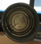
Cantenna
Made two, same design for both.
Gain is good: ~12dB.
 |
 |
 |
VLF Receiver
Fri, 04/05/2007 - 14:13 — balintDr John Smith told me about these types of receivers, so I thought I'd build the bare-bones-basic one.
Unfortunately it's not possible to use it anywhere near urbanised areas due to the 50Hz mains interference 'hum' that swaps out mother nature.
Popular content
Today's:
- About
- Turning the Navman S150 into a Bluetooth GPS receiver
- Update
- My blog lives elsewhere...
- Simplified Makefile System
- Aircraft Tracking with Mode S: Modez & Aviation Mapper
- My Bicycle
- Windows Side-by-Side Assemblies (WinSxS)
- USRP
- Restore the MBR and partition information, therefore restoring the file system
All time:
- About
- How to recover a RAID 0 disk array after losing the array’s metadata
- Making your iPhone look like a NMEA GPS receiver with gpsd and WiFi or Bluetooth
- Aircraft Tracking with Mode S: Modez & Aviation Mapper
- Australian Geographical RadioFrequency Map
- Windows Side-by-Side Assemblies (WinSxS)
- Dual monitor Quake III
- Determine the order of the physical disks in the array
- Tearable Cloth
- Update
AntiSpam spam counter
