Mapping Software
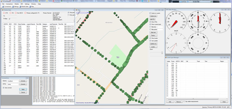
The mapping software brings all the data together and presents it on a map. Position and measurements are logged to a SQL database, and can be reviewed at will. The 'Level Layer Manager' allows customisation of data shown on the map. For example, one can choose to plot all measurements made on a particular ARFCN, and then further refine that to one cell by specifying the BSIC.
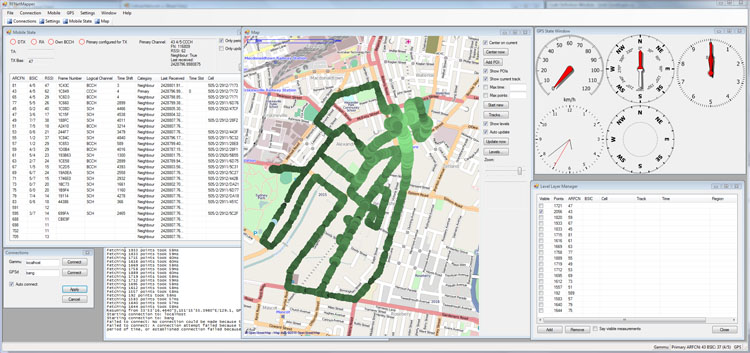
The funky GPS controls are from GeoFramework and GPS.NET. The map is rendered using GMap.NET and OpenStreetMap, which can of course be zoomed to show discrete samples:
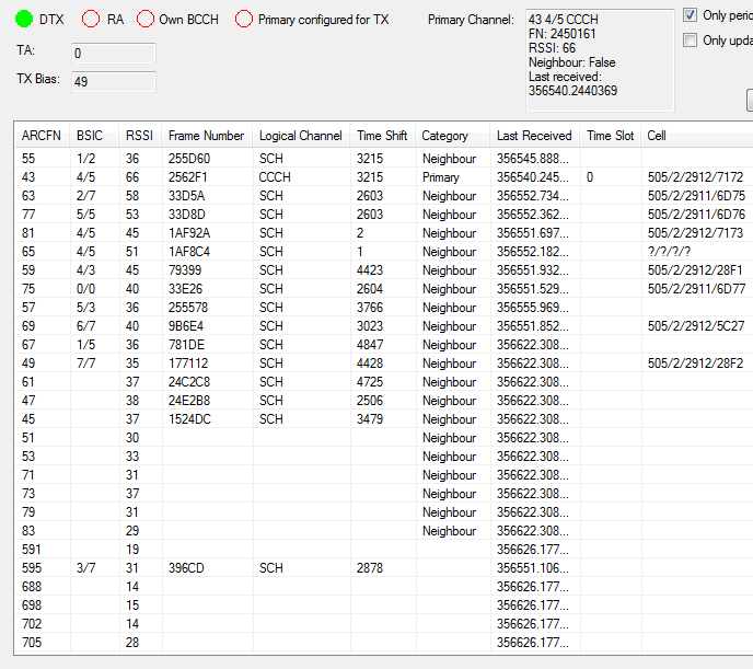
The Mobile State window displays the current state of the cellular network from the point of view of the phone:
The software could be appropriated to map any RF device that outputs signal strength measurements (e.g. a handheld receiver used for 'fox hunts').
Alas, the real geolocation (multilateration) process remains a TODO...
Popular content
Today's:
- About
- Turning the Navman S150 into a Bluetooth GPS receiver
- Update
- Simplified Makefile System
- Making your iPhone look like a NMEA GPS receiver with gpsd and WiFi or Bluetooth
- My Bicycle
- Software Defined Radio
- How to recover a RAID 0 disk array after losing the array’s metadata
- Restore the MBR and partition information, therefore restoring the file system
- Blue Milk
All time:
- About
- How to recover a RAID 0 disk array after losing the array’s metadata
- Making your iPhone look like a NMEA GPS receiver with gpsd and WiFi or Bluetooth
- Aircraft Tracking with Mode S: Modez & Aviation Mapper
- Australian Geographical RadioFrequency Map
- Windows Side-by-Side Assemblies (WinSxS)
- Dual monitor Quake III
- Determine the order of the physical disks in the array
- Tearable Cloth
- Update
AntiSpam spam counter
