Aircraft Tracking with Mode S: Modez & Aviation Mapper
Aviation Mapper is LIVE! Click here to use it.
The Aviation Mapper launch video
This project is a completely home-grown implementation of an aircraft tracking system using Mode S messages received on a Universal Software Radio Peripheral (USRP) from Ettus Research. The system comprises of a software-defined baseband decoder, a GUI front-end and a real-time (smooth) JavaScript-enabled Google Earth feed.
For the Mode S/aviation/RF enthusiast: If you are interested in various notes, diagrams and screenshots that are more technical than these series of pages, please check out the dedicated page on my wiki as well.
Modez, Aviation Mapper and Software Defined Radio featured in GQ Australia (April/May)!

Screenshots from the GUI front-ends:
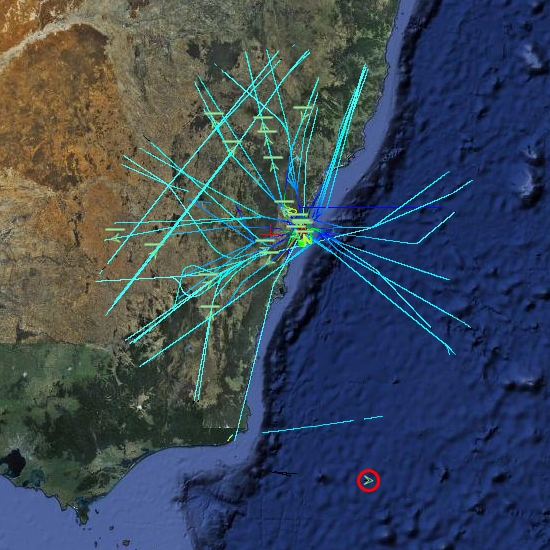
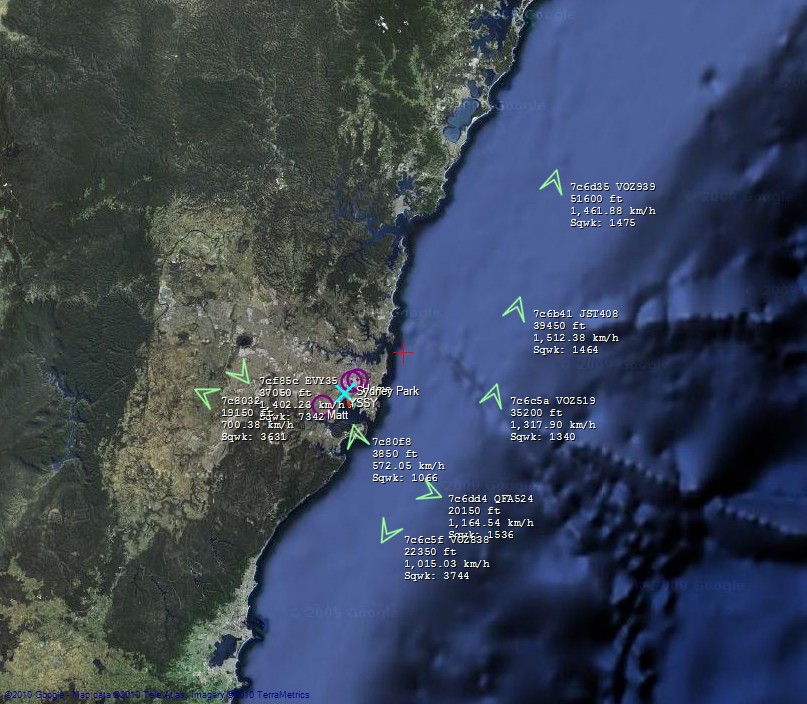
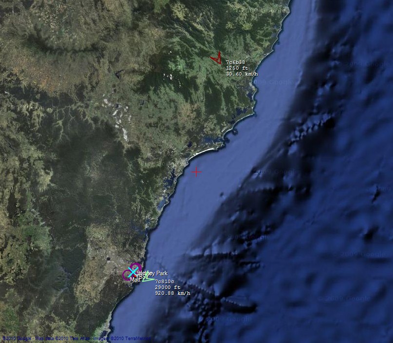
A plane at 514 km, with trails left behind showing flight corridors
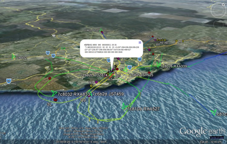
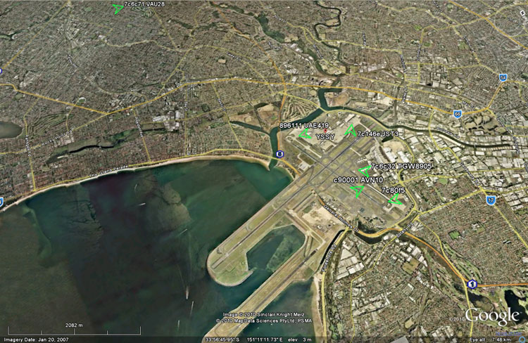
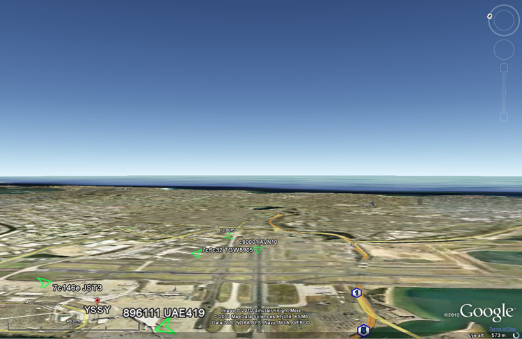
Looking at an angle at Sydney Airport, with planes landing on overlapping approach trails.
ACARS messages shown spatially as coloured dots with message label and content in balloon pop-up.
Spatial representation of ACARS message transactions building up over half a day
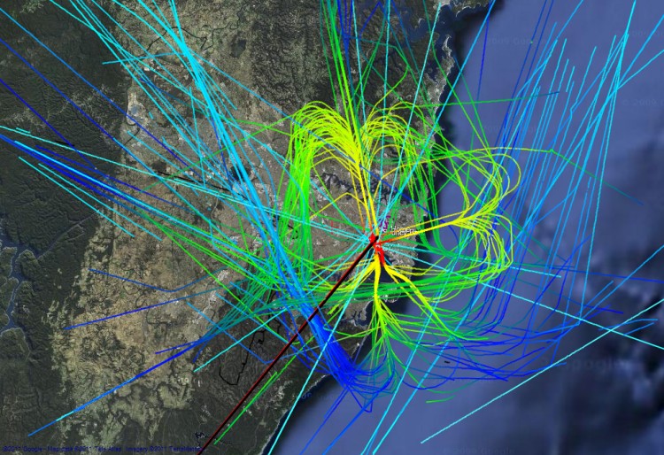
Accumulated flight paths over half a day
The Aviation Mapper desktop app
Running live at Sydney Airport streaming AvMap via 3G mobile Internet
Running the Aviation Mapper desktop app
Presentation at Dorkbot Sydney Finale 2011
Presentation at Ruxcon 2011: "Hacking the wireless world with Software Defined Radio
Click on a book section in the top left (or below) to explore the project further.
AviationMapper Demo
Aviation Mapper is LIVE! Click here to use it.
The Aviation Mapper launch video
Running live at Sydney Airport streaming AvMap via 3G mobile Internet
Running the Aviation Mapper desktop app
Presentation at Dorkbot Sydney Finale 2011
Presentation at Ruxcon 2011: "Hacking the wireless world with Software Defined Radio
The Early Days
These are screenshots from the first working version of the system. You'll notice one obvious bug: some of the altitudes are impossibly high (the was an extra un-necessary bit shift).
If you wish to see photos of the first proper outdoor test of the system on top of the tallest hill in Sydney Park, please have a look at the album in my gallery.
- The entire app:
- In a web browser with the Google Earth plugin:
- VAU28 coming in to land on RWY25:
- Here's a sample of the map:
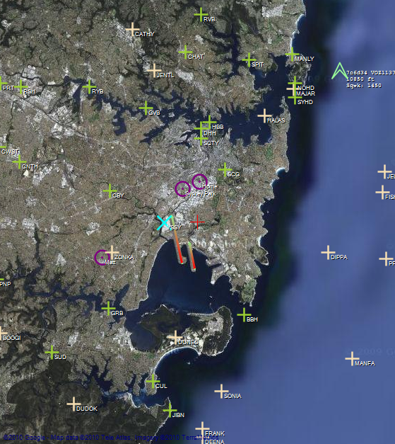
- This aircraft is the furthest one received so far (just shy of 300km):
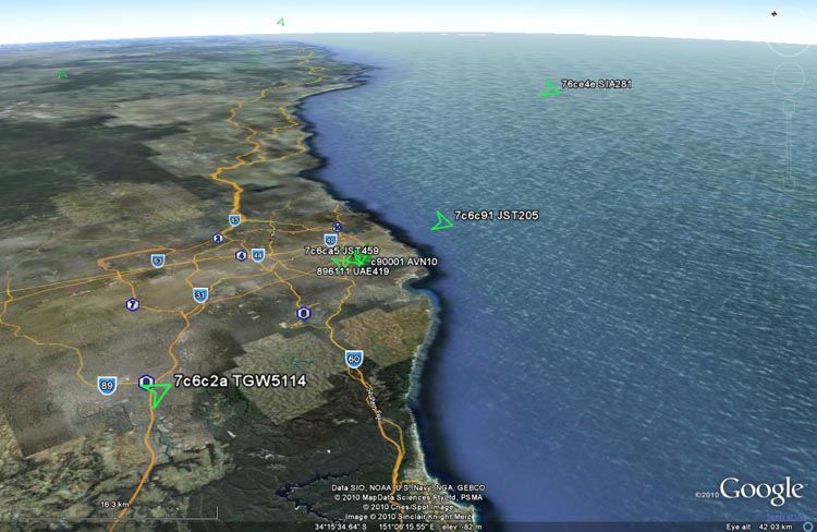
- The map can show some extra information, such as IFR/VFR markers, as well as the current runway configuration of your favourite airport (notice the red-green lines on 34L & R indicating the take-off direction):
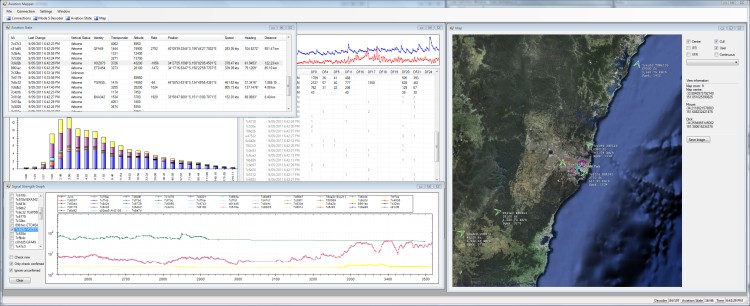
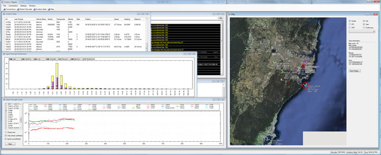
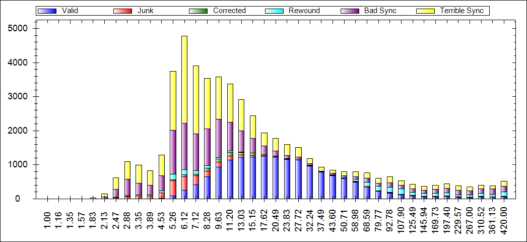
- The signal-strength distribution plot shows how the decoder is performing over a range of RSSI values:
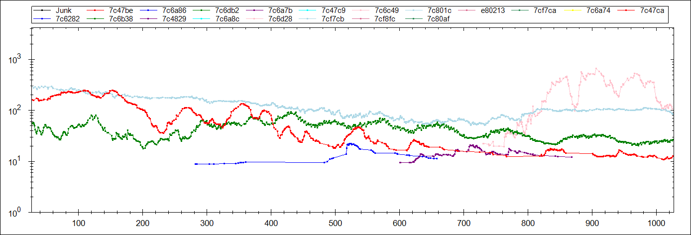
- There is also a per-airframe RSSI graph which is interesting to follow as an airframe approaches/flies away from the antenna:
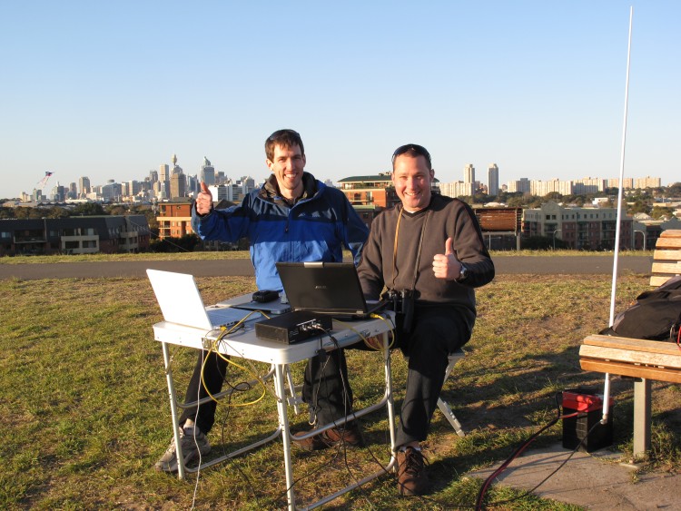
- Happy with the results (from the photo album of the first outdoor test):
Presentation at Dorkbot
Here are some excerpts of the presentation Matt Robert and I gave at the October 2010 meetup of Dorkbot Sydney.
If you wish to see all of the photos from the set-up phase prior to the presentation on the roof of my apartment block, please have a look at the album in my gallery.
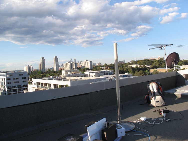
- Our setup on the roof:
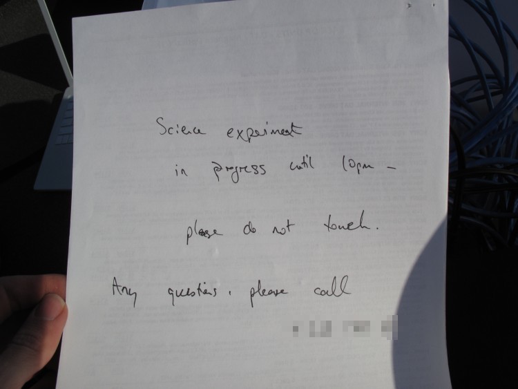
- Always good to leave a note:
Evolution: Cool Moments for Modez
The following series of images were captured/created when a milestone or new record was reached. There are more technical images and notes on the Modez wiki page. If you wish to see photos of the last major outdoor test, which involved five laptops, two USRPs and an SBS-1, please visit the album in my gallery.
- To get an idea of how full the sky is, the map is zoomed out significantly. The furthest plane is ~318km away:

- Live streaming JavaScript-based feed for Google Earth, including trails. Here an aircraft has taken off on runway 34R:

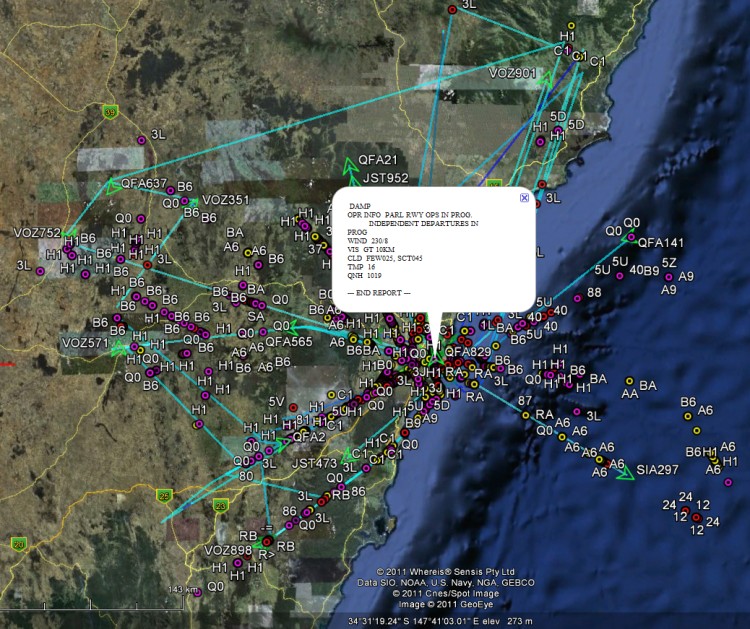
- Lots of surface position reports at YSSY:

- First non-aircraft surface position report (the gray airframe icon in the cyan circle):

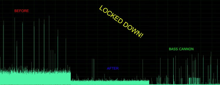
- Evolution of the DSP front-end in terms of improving the noise floor:
- Once again, happy with the results (and in the knowledge we're slightly nuts for lugging so much gear up a hill, and staying on into the cold, dark night):

Comparison to SBS-1
The aviation tracking system ("Modez") and an SBS-1 (thanks to Matt Robert) with its Base Station software were run side-by-side to undertake a rough performance comparison. For various technical notes on the SBS-1, including sampling the baseband output with an LFRX daughterboard, please see the page on my wiki. If you're interested in the photos of the major outdoor test where the SBS-1 was pitted against Modez, visit the album on my gallery.
Initially, this was done in the "RF quagmire" that is my "lab" - both antennas were placed right up against the window, although this doesn't help the fact neither see much of the sky. Here are some results:
- QFA764 is heard by Modez, but not yet by the SBS-1 (it hasn't appeared on the Base Station's aircraft-with-position list):


- Another example, VOZ873 has not yet shown up in Base Station's map (and Modez hasn't picked up the callsign of QFA459):


- TGW6105 is shown by Modez, but not in the Base Station list:


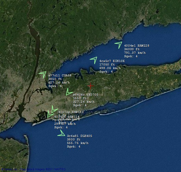
Mode S in the US
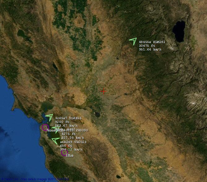
San Francisco & Silicon Valley:
New York, New York:
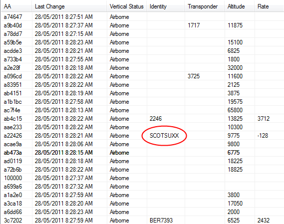
SCOTSUXX: